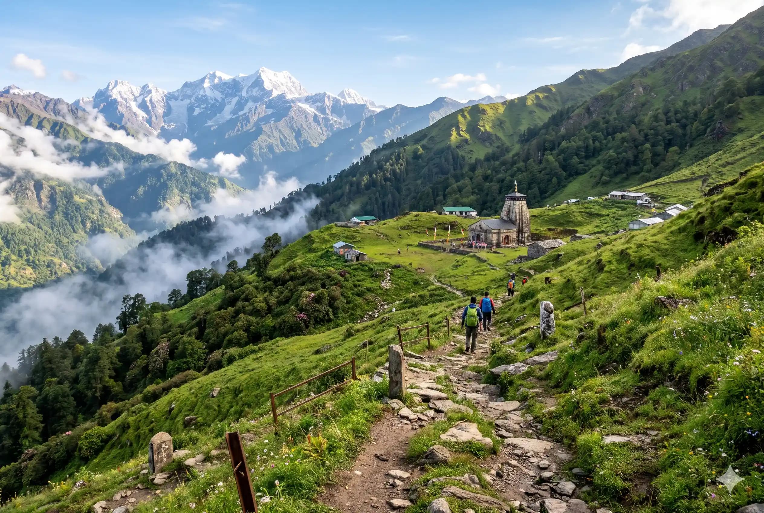
Madhyamaheshwar
Range
Garhwal Himalaya
Altitude
3497m
Difficulty
Moderate

Explore Offline
Download the app for 3D offline navigation, interactive trail maps, and emergency SOS tools.


About Madhyamaheshwar
Madhyamaheshwar (also called Madmaheshwar) is the second of the Panch Kedar temples, at about 3,497 m in the Garhwal Himalaya. The trek from Ransi village passes through traditional Garhwali villages (Gaundar, Bantoli, Khatara, Nanu, Kun Chatti) and dense oak and rhododendron forest, ending at a temple set in wide green meadows. A short climb above the temple to Budha Madhyamaheshwar gives close views of Chaukhamba, Kedarnath and Neelkanth. It is quieter and less crowded than Kedarnath.
Best time to visit
May, June, September, October, November
History & Significance
According to the Panch Kedar legend, the Pandavas sought Lord Shiva's forgiveness after the Kurukshetra war. Shiva took the form of a bull to avoid them, and parts of his body appeared at five places. At Madhyamaheshwar the middle part (navel/belly) appeared, which gives the temple its name (madhya = middle). The temple is believed to have been built by the Pandavas. Like Kedarnath, its priests traditionally come from the Jangam (Lingayat) community of Karnataka.
Places to See
Budha Madhyamaheshwar (2 km above the temple, with views of Chaukhamba), Kanchani Tal (high-altitude lake, a long extra trek for experienced trekkers), Bantoli (confluence of the Madhyamaheshwar Ganga and Markanga rivers), Gaundar village, Omkareshwar Temple at Ukhimath, Ukhimath town, Deoria Tal and Tungnath nearby.
Journey & Transport
Time to Reach
About 7 to 9 hours of trekking from Ransi, usually split over 2 days with a night halt at Gaundar, Bantoli or Nanu. 1 to 2 days to return. Budha Madhyamaheshwar is about 1 hour from the temple.
How to Reach
By road: Rishikesh - Devprayag - Srinagar - Rudraprayag - Ukhimath - Ransi (about 200 km, 7 to 8 hours). Ukhimath to Ransi is about 22 km. Nearest railway station: Rishikesh (Yog Nagari Rishikesh), about 200 km. Nearest airport: Jolly Grant, Dehradun, about 220 km. Buses and shared jeeps run from Rishikesh to Ukhimath; shared jeeps or taxis run from Ukhimath to Ransi.
Important Notes
Start early each day; afternoon clouds and rain are common. The descent from Ransi to Gaundar and the climb after Bantoli are steep, so good trekking shoes are a must. Carry cash, as there are no ATMs after Ukhimath. Carry warm layers; nights near the temple are cold even in summer. Avoid plastic and littering; the area is part of the Kedarnath Wildlife Sanctuary.
Facilities
- StayHomestays and lodges at Ransi, Gaundar, Bantoli, Khatara, Nanu and Kun Chatti. Basic guesthouses, dharamshalas and a GMVN rest house near the temple. Book ahead in May and June.
- FoodSimple meals (dal, rice, roti, Maggi, tea) at homestays and dhabas in every village on the trail and near the temple. Options close in winter.
- WaterAvailable at villages, homestays and dhabas on the trail. Streams and springs along the route; filter or purify before drinking. Carry at least 1 to 2 litres per person.