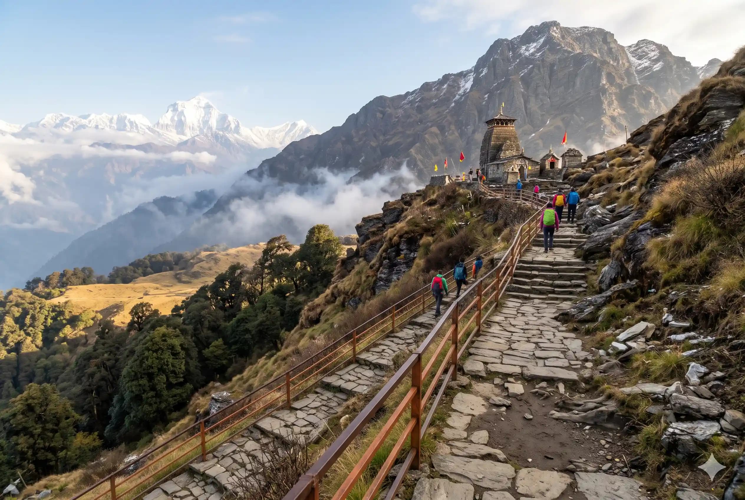
Tungnath
Range
Garhwal Himalaya
Altitude
3680m
Difficulty
Easy

Explore Offline
Download the app for 3D offline navigation, interactive trail maps, and emergency SOS tools.


About Tungnath
Tungnath is the highest Shiva temple in the world, at about 3,680 m in the Garhwal Himalaya. It is the third of the Panch Kedar temples. The trek starts at Chopta, often called the "Mini Switzerland of India", and climbs a paved trail through rhododendron forest and open bugyals (alpine meadows). From the temple you can carry on to Chandrashila peak (about 4,000 m) for 360-degree views of Nanda Devi, Trishul, Chaukhamba, Kedarnath and Bandarpunch.
Best time to visit
April, May, June, September, October, November
History & Significance
According to legend, after the Kurukshetra war the Pandavas sought Lord Shiva's forgiveness. Shiva avoided them by taking the form of a bull and sinking into the earth. His body later appeared in five places, which became the Panch Kedar. At Tungnath his arms (bahu) appeared. The temple is believed to have been built by the Pandavas, Arjuna in particular, and is associated with Adi Shankaracharya. Its priests come from the local Makku village. Chandrashila is linked to the legend that Lord Rama meditated there after defeating Ravana.
Places to See
Chandrashila Peak (1.5 km above the temple), Deoria Tal lake near Sari village, Chopta meadows, Ravan Shila, Kanchula Korak Musk Deer Sanctuary (Kedarnath Wildlife Sanctuary), Omkareshwar Temple at Ukhimath, Makkumath (winter seat of Tungnath).
Journey & Transport
Time to Reach
About 2 to 3 hours of trekking from Chopta to Tungnath, and another 45 minutes to 1 hour to Chandrashila. Allow 5 to 6 hours for the round trip.
How to Reach
By road: Rishikesh - Devprayag - Srinagar - Rudraprayag - Ukhimath - Chopta (about 210 km, 7 to 8 hours). Chopta can also be reached from the Gopeshwar/Chamoli side. Nearest railway station: Rishikesh (Yog Nagari Rishikesh), about 210 km. Nearest airport: Jolly Grant, Dehradun, about 225 km. Shared jeeps and buses run from Rishikesh to Ukhimath; take a taxi or shared jeep from Ukhimath to Chopta (about 30 km).
Important Notes
Start early; clouds usually build up by afternoon and hide the peaks. Carry warm layers and a rain jacket, as the weather changes fast. In winter, microspikes are recommended for the snow and ice. Avoid plastic and littering; the area is part of the Kedarnath Wildlife Sanctuary. Check road status from Rudraprayag to Ukhimath before travelling in the monsoon.
Facilities
- StayCamps, guesthouses and homestays at Chopta, Baniyakund, Duggalbitta and Sari village. Very limited basic rooms near the temple. No overnight camping is allowed in the Tungnath sanctuary area.
- FoodDhabas at Chopta and a few tea and snack stalls along the trail and near the temple (Maggi, tea, parathas). Stalls are closed in winter, so carry food then.
- WaterAvailable at Chopta and at the dhabas on the trail during the season. No reliable natural sources on the trail. Carry at least 1 to 2 litres per person.